For the last 6 days I’ve been on the road in the remote eastern provinces of Cambodia, exploring new locations for a photo tour which I plan to offer in the near future. I’m a huge fan of Cambodia because it has so much more to offer than just the well trodden temples of Angkor Wat in Siem Reap, so I’ve been exploring much of the country in between many of my NGO shoots here for the last few years.
As you probably know, in 2011, I started Angkor Photo Workshop, a 2 week long, intensive immersion into digital multimedia story telling led by myself and three other instructors, Matt Brandon, Gavin Gough and Marco Ryan. Cambodia is also the final stop in my Southeast Asia tour, additionally, I offer a “Cambodia extension” both the Vietnam Explorer Photo tour and the Amazing Myanmar Photo Tour.
Many of my tour participants fall in love with Cambodia and express an interest to explore the country more extensively, and so, for several years I have been thinking of offering an “Off-The-Beaten-Track Cambodia Tour”.
With all of this in mind, I took the opportunity to visit Mondulkiri , Kratie and Ratanikiri this week. Since I had limited time, and needed to have the flexibility of stopping where I wanted, bus travel was not an option, so I contacted my friend Samreth, who is a police officer as well as a part time taxi driver. I met Samreth years ago at the Foreign Correspondent’s Club in Phnom Penh. Samreth owns a very reliable late model, Toyota Camry and having never visited the east of his own country, he was keen to make the trip. We made plans to meet in Kompong Cham and headed into Camobodia’s “wild east”, in search of interesting, photogenic people and places.
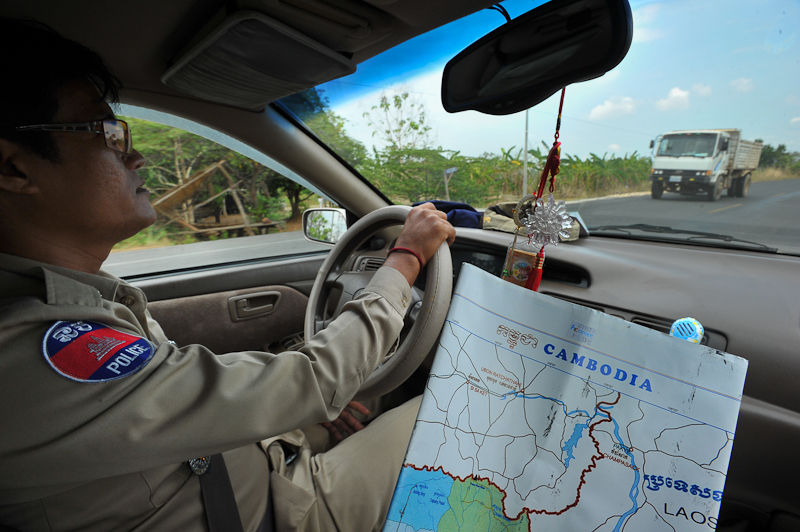 I had two maps, one made in Cambodia, the other, made in USA. There were a few discrepancies between the two maps. I believe that the Cambodian map made a few “assumptions” about roads that were “to-be-completed” in the near future, but as of yet had not been finished. The made in the US map was a bit more accurate. Anyway, we would be asking locals along the way to determine actual, up to date information. Since Samreth is a police officer, he was the perfect person to help expedite the occasional police road-blocks where cars are often stopped for bogus “minor infractions” and charged small fees (payable on the spot, without any paperwork). Of course, these collections probably never make it beyond the pockets of those who collect them….ahhh, Cambodia.
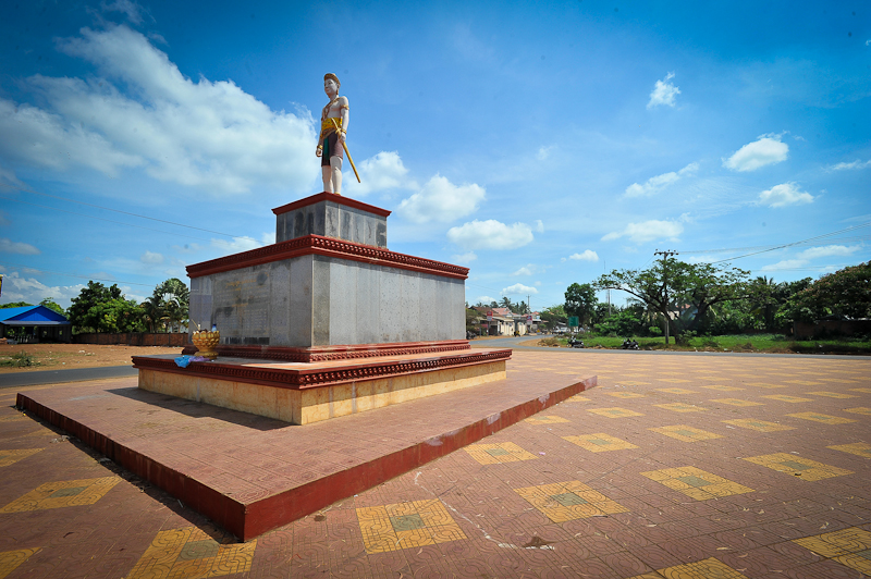
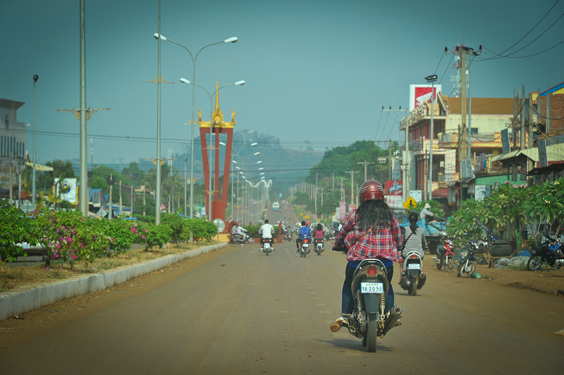
Traffic circle with statue at Krek, Cambodia, where a secondary road leads to the Vietnam border just a few kilometers away
Throughout this blog post, I’ll be describing the trip with some text and images. The first leg or the journey, from Kompong Cham to Sen Monorom was better than expected, with mostly new black top, and only several unfinished sections consisting of dirt or gravel. We encountered only sparse traffic along the way after passing Snoul, a small town at an intersection between Kompong Cham and Sen Monorom.
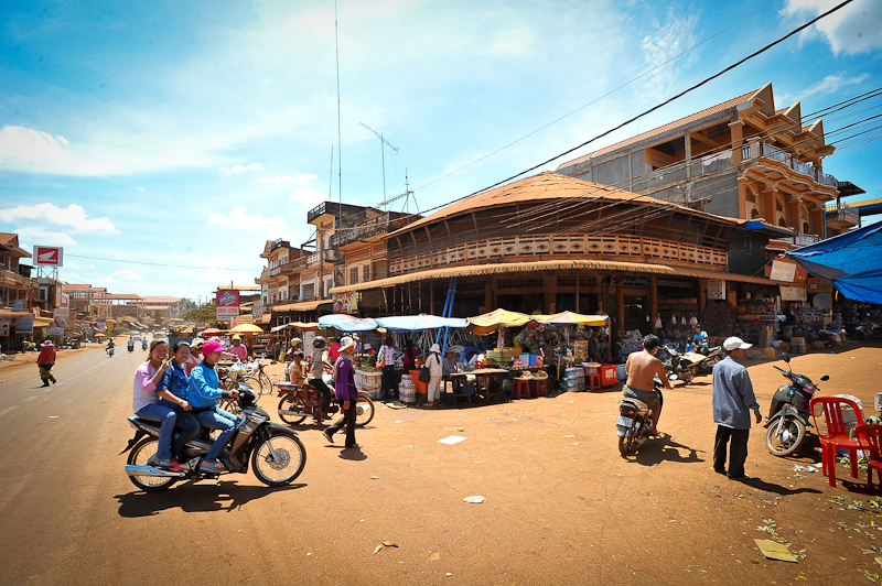 Market at Memot, along National Highway #7 en route to Snoul
Passing Snoul, we continued toward Mondulkiri. Mondulkiri means ‘Meeting of the Hills, and at an average elevation of 800m, it’s an appropriate name based on the surrounding geography and unlike much of Cambodia, it can actually get quite chilly at night.
Mondulkiri is the most sparsely populated province in the country, with just two people per sq km. Almost half the inhabitants come from the Pnong minority group, with other minorities making up much of the rest of the population. There has been an influx of migrants in recent years, drawn to the abundant land and benign climate. Fruit and vegetable plantations are popping up, but hunting remains the profession of choice for many minorities. Conservationists have grand plans for the province, creating wildlife sanctuaries and initiating sustainable tourism activities, but are facing off against speculators and industrialists queuing up for natural resources.
 Roadside gas station (don’t drink the Pepsi) at Snoul
The entire journey from Kompong Cham to Sen Monorom took only 9 hours total and the road, which skirts the Vietnam border, passed through areas of rice paddies, rubber plantations, slash and burn plots, small road side villages and some rolling hills. As we drove deeper into Mandalkiri province, we gained elevation from the lowlands to the relatively high altitude of Sen Monorom.
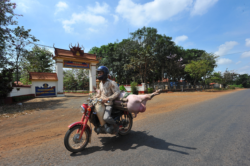 National Highway #7, moto-driver transporting a pig to the local market
Along the road, rural Cambodia unfolded, with typical sights, like the occasional motor bike, transporting a pig to the market. Kilometer after kilometer passed and before long we were getting close to Sen Monorom and it looked like I would have the opportunity to get to Bou Sraa waterfall before sunset, so we found a hotel, dumped the luggage, grabbed my cameras, and headed to Bou Sraa.
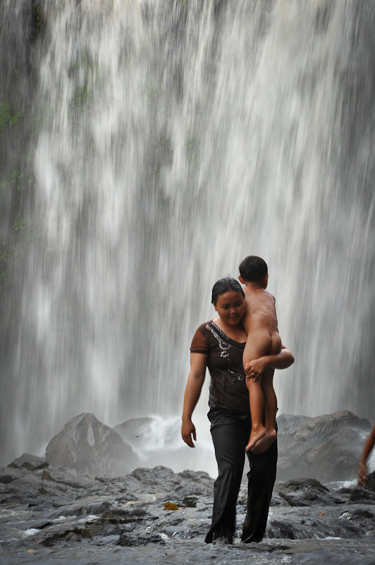
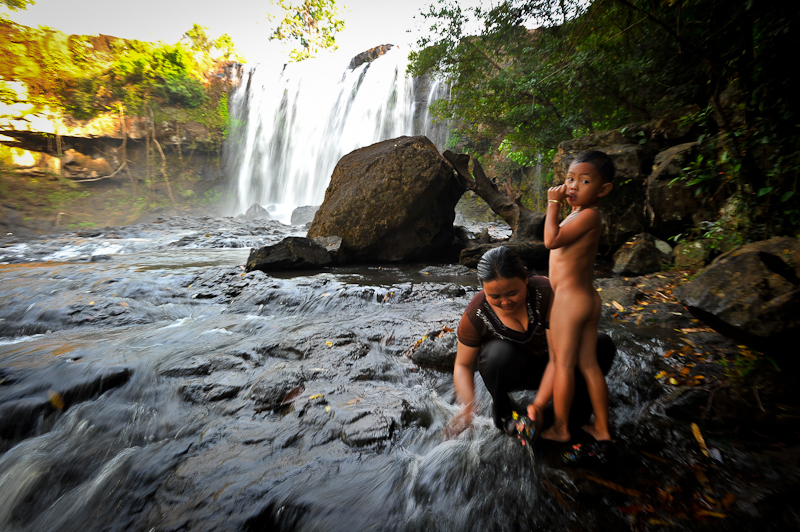
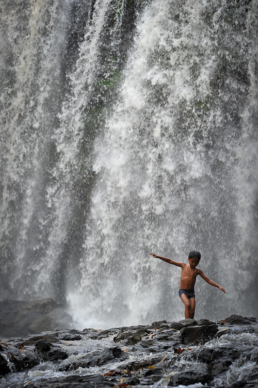
The double-drop waterfall of Bou Sraa is one of the largest in Cambodia and famous throughout the Country. It’s an unforgiving 35 km journey east of Sen Monorom, but the reward is worth the effort. The upper tier of Bou Sraa drops some 10m and the lower tier drops 25m
The graded dirt road was in good condition and it took only about 40 minutes to cover the distance. On arrival, things at Bou Sraa looked very peaceful, with only 4 other foreigners and 3 Cambodian families picnicking under the falls.
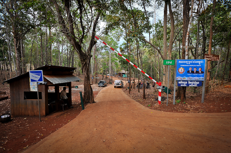 Entrance gate, Bou Sraa waterfall, Mondulkiri
 Cambodian and Vietnamese tourists making photographs at the statue of two bulls at the main intersection (traffic circle) in San Monorom
It seems that every Cambodian town has there own “middle of the road statue” which differentiates it from all other towns. Here In San Momnorom, the statue is of two large water buffalos.
After exploring the sights in and around Sen Monorom, it was time to head north to Ratanikiri. From the looks of the maps, there appeared to be a road from Sen Monorom to Ban Loung, Ratanakiri (a distance of about 160 km,) but according to the locals, some internet exploration and from Sateth’s friend, the road was not passable by car, and much of the area was still being cleared of land mines, left over from years of conflict in this border area, a long time strong hold of the Khmer Rouge . Given the information at hand, Samreth and I decided to take the “sure thing” route, which meant back tracking from Sen Monorom to Snoul, then heading north through Kratie towards Stung Treng and then east to Ban Lung in Ratanikiri.
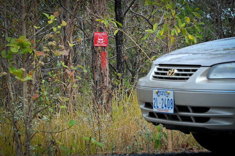 Be careful when stopping along the road for necessary “bathroom breaks”, as many land mines still remain along the way.
 With Samreth sporting his police uniform, occasional road-blocks like this were a breeze, as we were waved through like a VIP.
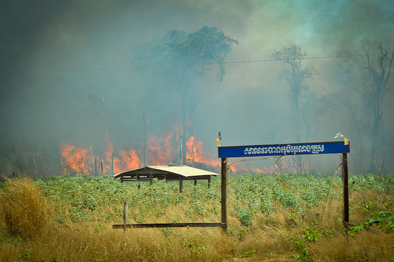
 Slash and burn farming techniques seem to be common practice here.
The trip from Sen Monrorom to Ban Lung took about 9 hours total, with a quick stop for lunch at a fork in the road which splits travelers heading north to Steung Treng or east to Ratanikiri.
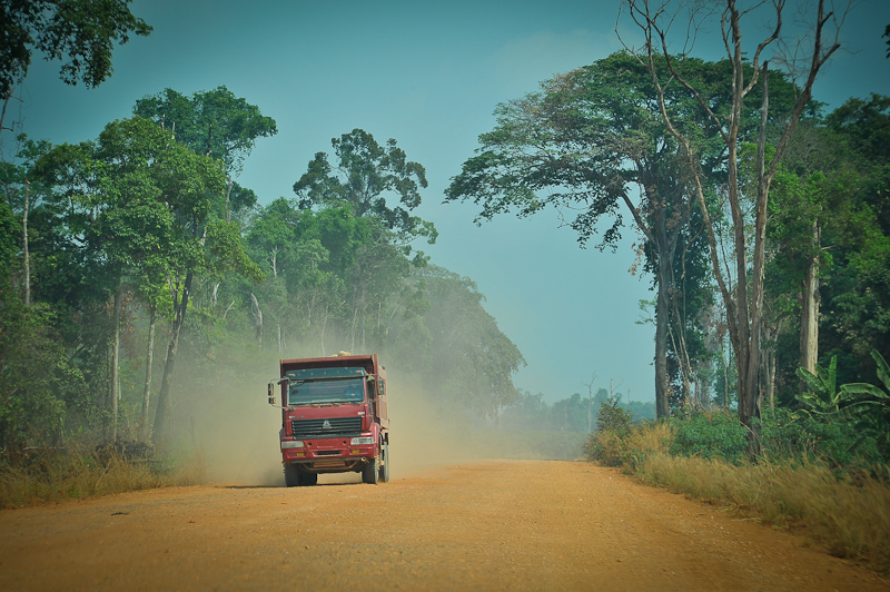
Again, the road was for the most part in nice condition, much of it new, smooth, blacktop. The terrain along the way was varied, including green areas along the Mekong north of Kratie, to some very dry areas with choking red dust and little or no vegetation.
Arriving in Ban Lung was much like the arrival in Sen Monorom, with cooler, higher elevations and rolling hills all around.
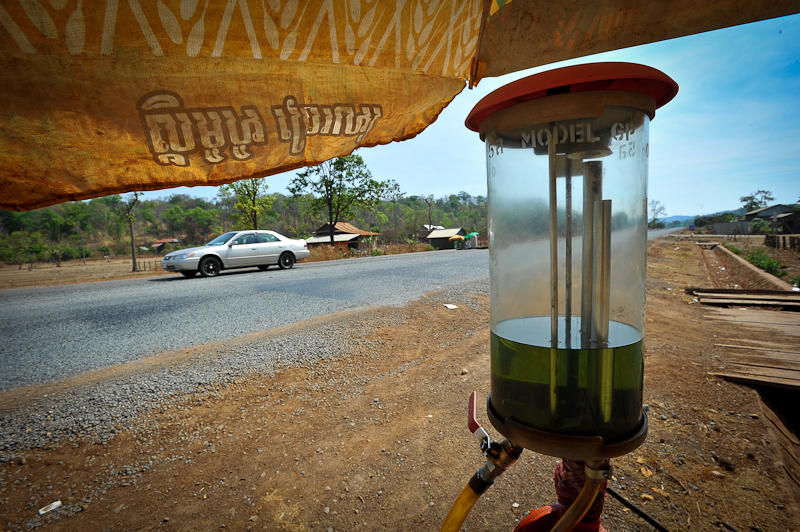 Roadside gas station, Ratanikiri Provence.
The Ratanikiri province is know for “tribal people” and for several “crater lakes” and waterfalls and the Virachey National Park. Many of the most interesting sites here in Ratanikiri are found in areas that are largely accessible only by several days trekking. Virachey National Park was established in 2004 by MoE (Ministry of Environment). With its 3.325 square kilometers, Virachey is the largest National Park among seven other National Parks in Cambodia.
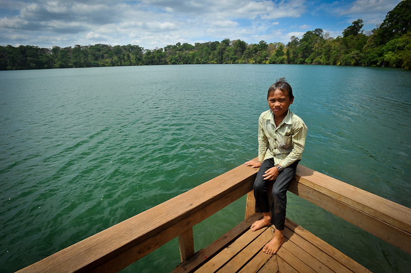 Yak Lom Crater Lake A round, crystal clear lake in a community of hill tribes surrounded by jungle, Yak Lom Lake is Ratanakiri’s can’t miss destination. It’s a popular place for Cambodians on vacation who take a swim or picnic on the shore.
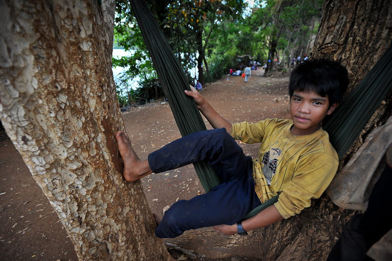 relaxing in a hammock, Yak Lom Lake
From Ratanikiri, Samreth and I headed to Kratie, Kampi and Chhalong to explore the riverside communities that occupy the eastern bank of the Mekong river. The biggest attraction in this area is a species of fresh water dolphin, known as the Irrawaddy dolphin, which is an endangered species throughout Asia, with shrinking numbers inhabiting stretches of the Mekong in Cambodia and Laos, and isolated pockets in Bangladesh and Myanmar.
In Cambodia, in the tiny village of Kampi, 15km north of Kratie town, the Irrawaddy dolphin has become a symbol of the town’s rejuvenation after years of war and neglect. The dolphins here, live up to 30 years and grow up to 2.75m in length, with weight as large as 150kg.
The dolfins are easy to find, lolling about on the surface, or breaking water with a distinctive puff of spray while chasing fish. I hired a boat for an hour ($7) and less than 100 meters from the shore we spotted our first dolphins!
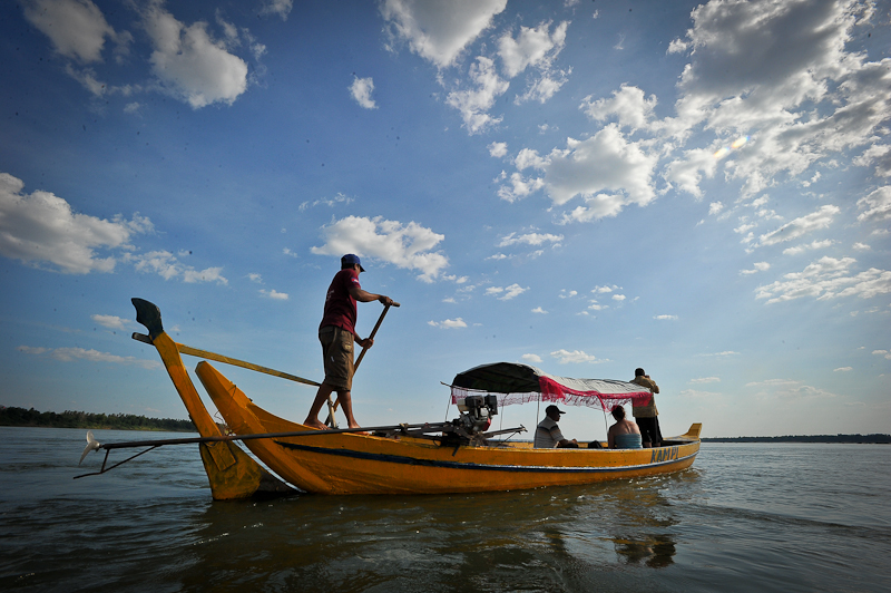
The boat men are trained to turn off their motors to approach the dolphins and maneuver with wooden oar. In just over an hour on the boat, I encountered dolphins about 50 times, at a ranges as close as 25 meters.
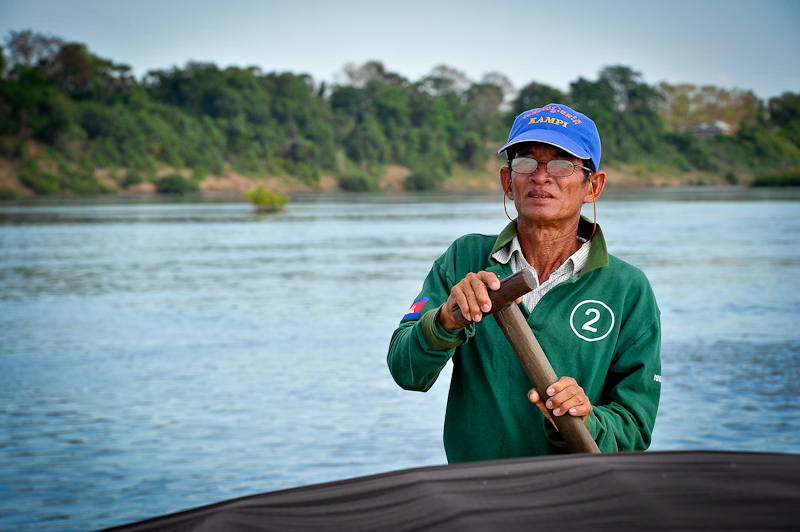 Boat captain stops the engine and begins paddling, while he checks the horizon for signs of dolphin activity.
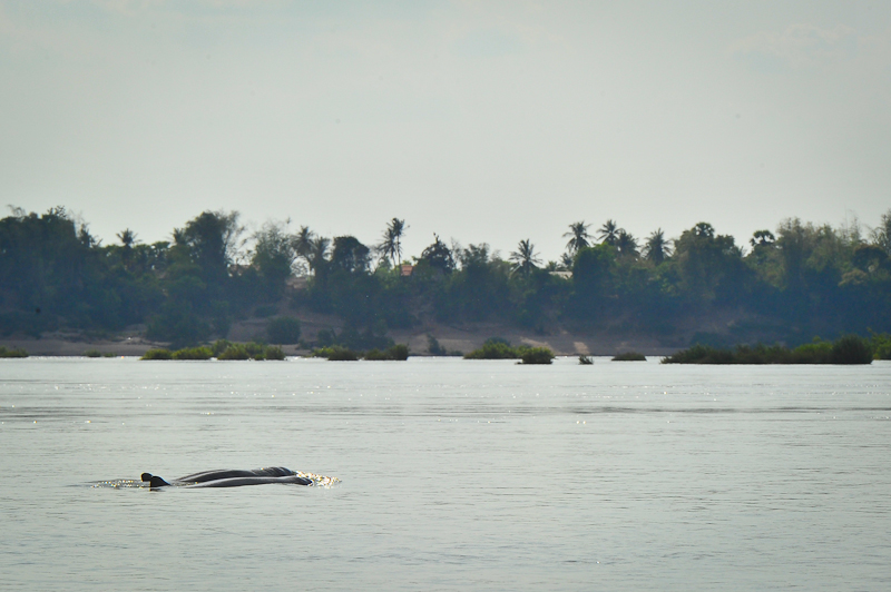 Two Irrawaddy dolphins break the surface.
After viewing the dolphins, Sartheth and I headed for Kompong Cham, about 3 hours south. Along the way I was thumbing through some of my Cambodia information and read about a small temple complex called Bantea Chhmar north of Sisaphon. Here’s what caught my attention…
“A complex of eight temples deep in the Cambodian jungle, Banteay Chhmar was commissioned by the twelfth-century Khmer ruler Jayavarman VII. Built over nine square kilometers and surrounded by a moat, the site echoes the architectural layout of the Khmer temple complexes of Angkor Wat and Angkor Thom. The site is renowned for its beautifully rendered bas-reliefs, which depict the war between the Khmer and Champa kingdoms Despite its remote location, the site was affected by the chaos of Cambodia’s civil war in the 1970s. During the reign of the Khmer Rouge, Bantea Chhmar was unattended, and many of the temples were engulfed by tropical foliage. In the aftermath of the Khmer Rouge period, the site fell victim to significant looting of bas-reliefs and statuary.
Hmmmm….I think another road trip might be in order as I still have a few days before heading to Vietnam for the start of this year’s photo tour.





Hi Karl,
Thanks for taking the time to share your fascinating journey and intriguing images. I especially like the hammock boy and final shot of the dolphin boat. Have fun exploring Banteay Chhmar!
Lisa